Exploring the Vecht
How do all the big sailboats get into the Vechtplassen?
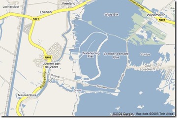
A map of the area shows the lakes to the right, and the twisting Vecht river to the left, passing through (of course) Loenen aan de Vecht. The straight cut of the Amsterdam-Rijnkanaal passes diagonally at the far left.
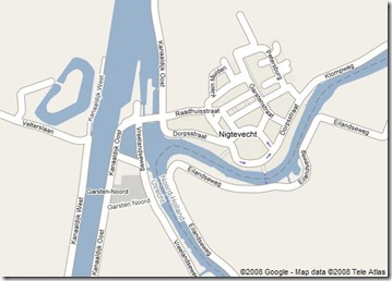
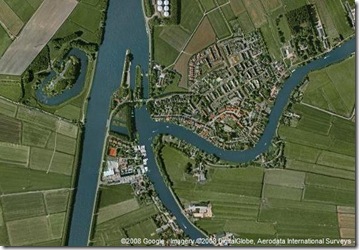
The Kanaal is the logical place for large boats to pass from the sea into the Plassen, but as I search along it's length, I could not find a direct connection to the Vecht river. The closest suggestion seemed to be at Nigtevecht, a small village east of Abcoude. Google's maps have a suggestion of a connection to a bend in the Vecht, but the arial shot is certainly ambiguous.
It's a slow, sunny Sunday: so why not check it out?
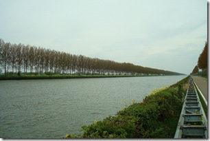
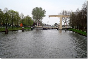
The Amsterdam Rijnkanaal must be one of the most utilitarian waterways anywhere: dead straight, lined only with a road, a railroad, and a single row of trees. The only interesting thing is that the water in the canal is visibly higher than the level of the surrounding fields: I have absolute confidence in Dutch mastery of this balance.
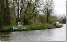
Arriving in Nigtevecht, this is the view east at the bend in the Vecht with the canal to my back. The river bend is tagged with markers pointing the way north to Muiden.
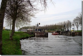
However, a bit of tramping about (and ignoring a few "verboden toegang" signs) does turn up the connection between the two.
Locks with a slot between them, one opening directly onto the Canal, and another beneath the bridge. Today, both sets of gates were open. So, interestingly, the river and the canal sometimes, but not always, need to be separated, and the Dutch have defined spots along the Vecht where this can happen. The direction of the lock's opening suggests that the water rises higher on the canal side locks, and that they form a barrier to prevent backflow into the Vecht when this happens.
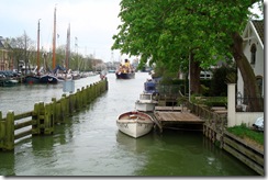
It's also clear that, far from being a meandering creek, the Vecht is a perfectly navigable river in its own right. Few pleasure boats seemed inclined to challenge the commercial traffic on the canal: mostly they steamed from the south, around the bend, and on towards the Ijsselmeer without a glance at the Amsterdam-Rijn.
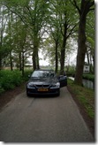
'Just to prove it, I drove the single lane riverside road out of Nigtevecht all the way up towards Weesp. It's a nice lane, lined with chateaus and cottages, too tight for cars to pass, so I periodically had to back up to clear the road for others.
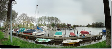
So, I arrived in Muiden with a much better understanding of why the castle is there: protecting the mouth of the Vecht as the waterway into the heart of North Holland. And, best of all, it was still early enough to find a table along the locks, catch a bit of sun, and watch all the boat traffic.
Labels: Dutch Artifacts, Everyday life in the Netherlands, Picture Post, Travel stories

2 Comments:
sounds like a fun day out exploring
At least we beat the rain!
There were lots of spots along the way, out in the countryside, where I wanted to go biking instead of driving: the lanes really aren't made for cars. I need to pick up something before the summer really arrives.
Your walks sound great, but my ankles don't let me cover the miles as easily as I used to.
Post a Comment
Subscribe to Post Comments [Atom]
<< Home